
NOAA - Great Lakes Environmental Research Laboratory

In 2015, NOAA GLERL began a weekly airborne campaign to assist in improvements to the HAB forecast for cyanobacteria harmful algal blooms in the western basin of Lake Erie. This airborne campaign is ongoing in conjunction with our weekly Lake Erie monitoring and biweekly monitoring in Saginaw Bay.
|
|
|
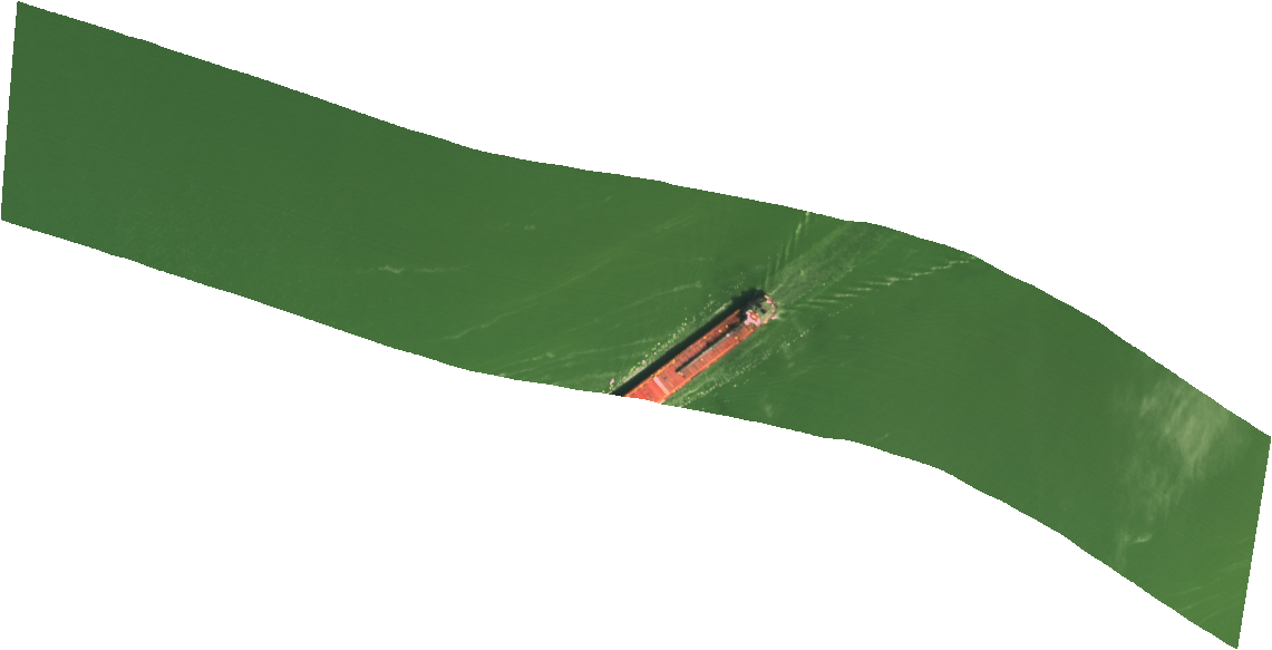
Hyperspectral scan taken over Maumee Bay, Lake Erie, on August 19, 2019. |
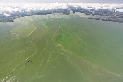
Aerial image take over the same location on Maumee Bay, Lake Erie on August 19, 2019. Credit: Zachary Haslick, Aerial Associates Photography, Inc.. |
The weekly airborne images are hyperspectral, meaning they contain many more spectral bands of discrete wavelengths than a typical spaceborne satellite image. At NOAA GLERL, we use the Resonon Pika II and the Pika L hyperspectral camera, otherwise known as a hyperspectral imager. Images from the Pika II have 240 bands and the Pika L has 281 bands. These bands span the range of 400 to 1,000 nanometers, where the visible range that the human eye sees is from about 380 to 750 nanometers. The aircraft usually flies at an altitude that allows researchers to obtain images that are 1-meter to sub 1-meter pixel size, also called the spatial resolution. Hyperspectral imagers offer a finer pixel size, depending on the altitude flown, compared to the typical 1-kilometer spatial resolution from multi-spectral spaceborne satellites. They also offer many more bands that can be used to differentiate between many different types of spectral features, including algal groups. Due to cloud cover, typical spaceborne satellites that are multispectral are only capable of capturing 20-30 images in the spring-fall period when blooms are present. Hyperspectral images are obtained even on cloudy days, as the plane is able to fly under the clouds. All of these benefits of hyperspectral imagers offer water intake managers a key resource for identifying the type and location of algal blooms near water intake systems.
These hyperspectral images are now available through the NOAA National Centers for Environmental Information (NCEI) website. The data sets are described and linked to NCEI below.
Hyperspectral imagery to study harmful algal blooms (HABs) of Lake Erie, Lake St. Clair, and Saginaw Bay, Lake Huron of the Great Lakes region (links to NCEI)
The hyperspectral images in this collection contain flights over the western basin of Lake Erie, and Saginaw Bay, Lake Huron of the Great Lakes region during the HAB season from typically June until the end of October. Images were acquired from a manned aircraft with a Resonon hyperspectral imaging camera. Each flight has approximately 200-400 images along the flight trajectory that are in band interleave per pixel (.bip) or band interleave per line (.bil) format. The files are in raw binary, radiance values, and reflectance values. The resolution is typically 1 meter or less depending on the altitude that is flown. The flight path covered the Michigan and Ohio drinking water intake locations and also the Cooperative Institute for Great Lakes Research (CIGLR) water quality monitoring stations in western Lake Erie. Each flight took into account the solar zenith angle to minimize sun glint correction. The data are currently in raw and radiance formats that were converted to radiance using the calibration files provided by the manufacturer and no other corrections have been made. The camera is sent annually to be calibrated by the manufacturer. Imagery was collected to monitor harmful algal blooms (HABs) over the western basin of Lake Erie and Saginaw Bay, Lake Huron. Funding for this project was received via the Great Lakes Restoration Initiative (GLRI) from the U.S. Environmental Protection Agency (USEPA).
For more information, please contact:
