
NOAA - Great Lakes Environmental Research Laboratory

 |
NOAA/GLERL is not an operational center. We make every effort to ensure accuracy and minimize downtime, however, we cannot guarantee that data and products will always be available and/or accurate. Our forecasts and products should be considered experimental. Please review our disclaimers. |
This project is funded by the International Joint Commission's Lake Champlain-Richelieu River Study.
Lake Champlain has experienced several flood events over the past decade, causing destruction of property and infrastructure in the binational basin. To better prepare for flood events, NOAA GLERL and the University of Michigan Cooperative Institute for Great Lakes Research (CIGLR) developed a real-time flood forecast modeling system for the Lake Champlain-Richelieu River basin. This system will inform future operational flood forecasts for the Lake Champlain-Richelieu River system and support inundation mapping as well as recreational forecasts and search and rescue efforts.

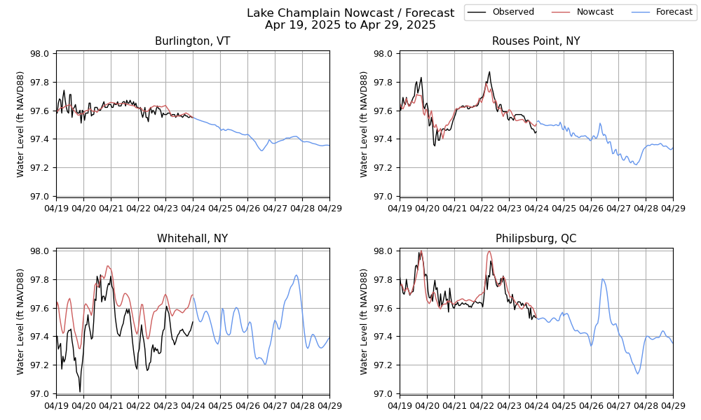
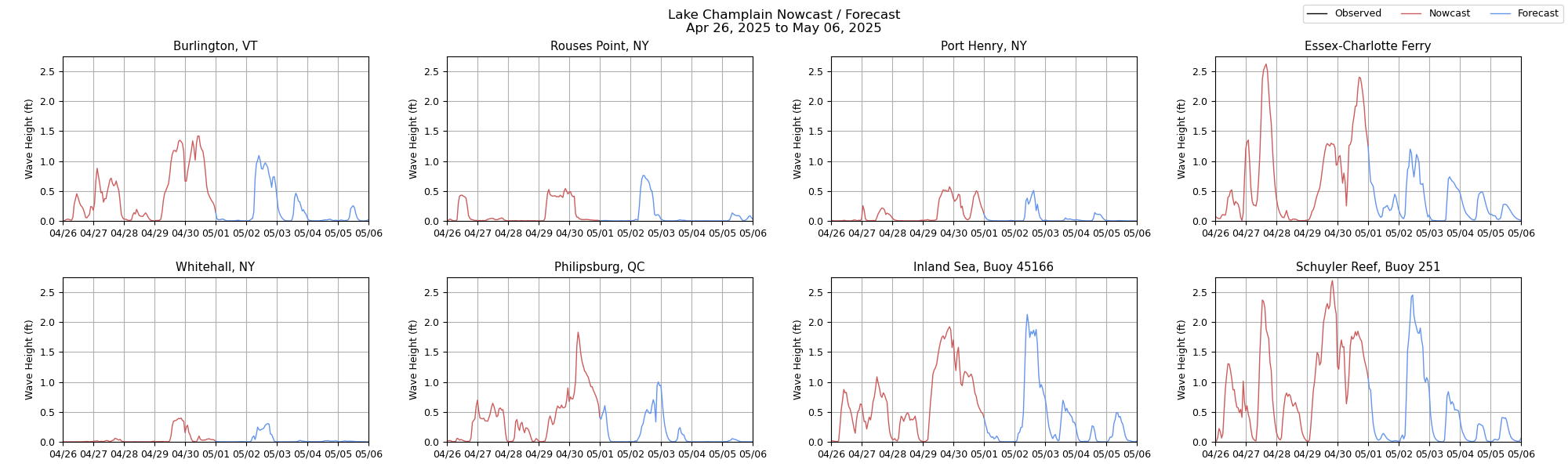

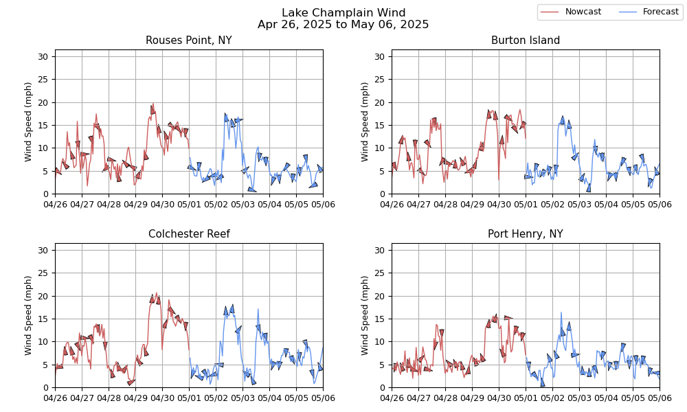
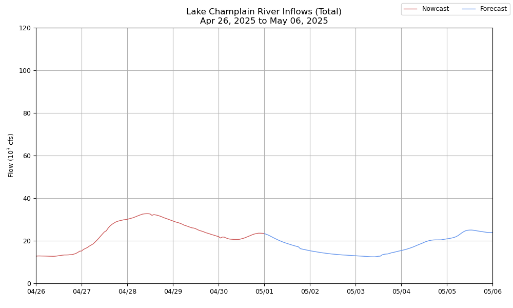
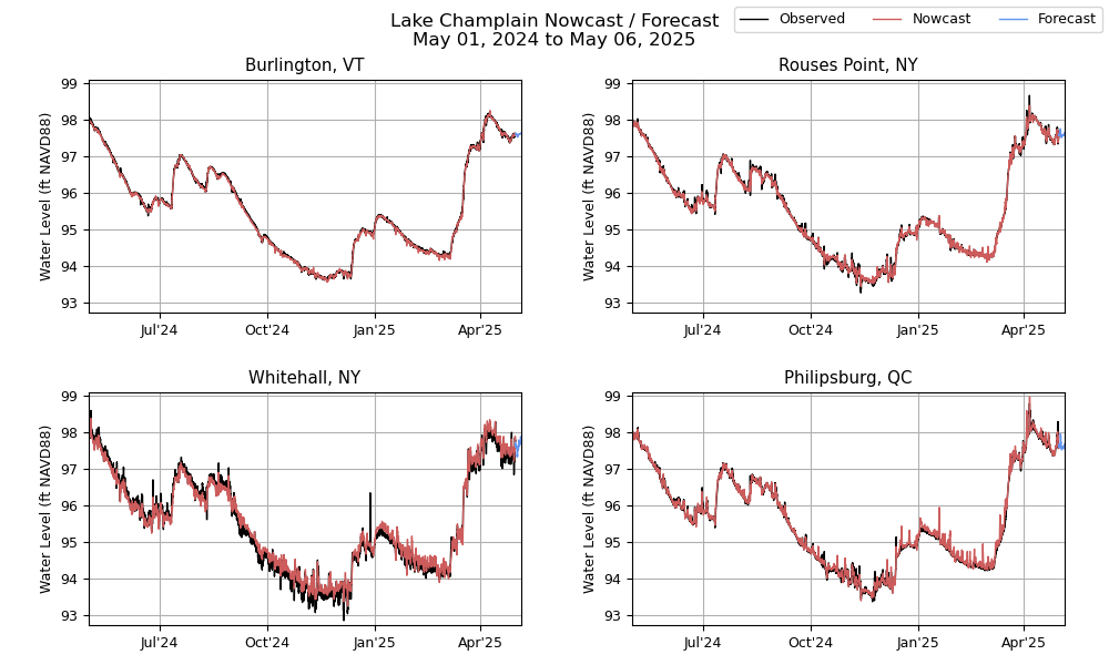
Lake Champlain flood forecasting system couples state-of-the-art hydrologic, hydrodynamic, and wave models. The system resolves wind-driven spatial variability in water levels, surface waves, and the associated extent of coastal inundation. The modeling framework couples the National Water Model (NWM) to a three-dimensional hydrodynamic model based on the Finite Volume Community Ocean Model (FVCOM), with atmospheric forcing from the NOAA High-Resolution Rapid Refresh (HRRR) and Global Forecasting System (GFS) operational models. Wind waves are predicted by an application of the WAVEWATCH III spectral wave model, with wetting/drying in floodplain areas informed by FVCOM.
The nowcast is updated four times per day, running at 00:00, 06:00, 12:00, and 18:00 UTC. A 5-day forecast is produced once per day from 00:00 UTC.
