Happy Valentine’s Day from NOAA’s Great Lakes Environmental Research Laboratory! Here’s a look at the Great Lakes science that inspired our GLERL-themed valentines.

Lake Erie’s central basin is a vital drinking water source for over two million people along the Ohio coast, but drinking water treatment plants in this region face significant challenges during the summer. The lake water stratifies, creating a distinct separation between warm surface water and cold, dense bottom water. The deep water often becomes hypoxic (low in dissolved oxygen) and has a low pH and elevated levels of iron and manganese. This hypoxic environment is typically inhospitable to many animals. Strong wind events can cause upwelling, bringing this cold, hypoxic bottom water to the surface near the lakeshore, which can interfere with the drinking water treatment process.
To address this issue, NOAA GLERL and the Cooperative Institute for Great Lakes Research developed a forecast model of hypoxia and circulation in Lake Erie to alert decision makers of when upwelling may bring hypoxic water to the shore. The hypoxia forecast is now being maintained by NOAA’s National Centers for Coastal Ocean Science. Learn more

Remote sensing is the science of obtaining information about objects or areas from a distance, typically from aircraft or satellites. One method of remote sensing is the use of airborne hyperspectral cameras, which contain many more bands of discrete wavelengths than photos from a typical camera. NOAA GLERL scientists use these images to study properties like turbidity and chlorophyll during the winter and harmful algal blooms in the summer.

NOAA GLERL’s experimental Great Lakes Coastal Forecasting System (GLCFS) is an experimental set of hydrodynamic computer models that predict lake circulation and other physical processes, such as thermal structure, wind, short-term water level changes, and ice dynamics. These research models provide timely information on currents, water temperatures, short-term water level fluctuations (e.g. seiche, storm surge), and ice out to 120 hours into the future.

NOAA GLERL has been exploring the relationships between ice cover, lake thermal structure, and regional atmospheric patterns for over 30 years. Our research focuses on historical model simulations and observations of ice cover, surface water temperature, and other variables. Studying, monitoring, and predicting ice cover on the Great Lakes is important because ice plays an important role in determining regional weather, timing of evaporation, water movement patterns, water temperature structure, and spring plankton blooms.

Harmful algal blooms (HABs) in the Great Lakes occur when algae grow rapidly, forming dense scums and water discoloration. Some blooms can produce neurotoxins, liver toxins, or skin irritants and can be very dangerous to come into contact with. These blooms can contaminate drinking water, harm swimmers and pets in areas where toxins are concentrated, and pose a severe nuisance to recreational and commercial boating and fishing.
NOAA GLERL’s HAB research focuses on understanding and predicting blooms by integrating monitoring and real-time observations, forecasting and 3-D modeling, and remote sensing. NOAA GLERL research on the formation, duration and toxicity of HABs is used to create products for stakeholders, coastal communities, and the public for making important decisions, such as managing drinking water treatment plants. Learn more and access NOAA GLERL’s HAB data.

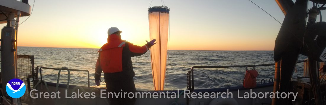
Much of NOAA GLERL’s Great Lakes science would not be possible without our fleet of research vessels. The R/V Laurentian is NOAA GLERL’s largest vessel and one of our most important assets. Added to our research fleet in 2002, the 80-foot vessel has many unique features that make it a fundamental component of our Great Lakes science. The Laurentian is based out of GLERL’s Lake Michigan Field Station in Muskegon, MI and supports a large portion of our ecosystem research, including lower food web dynamics, benthic surveys, and winter ecology.

NOAA GLELRL’s Realtime Coastal Observation Network (ReCON) consists of high-tech buoys across the Great Lakes that collect meteorological data as well as chemical, biological, and physical data below the lake surface. In the western basin of Lake Erie and Lake Huron’s Saginaw Bay, our buoys help us monitor algal bloom conditions in near real time.