
NOAA - Great Lakes Environmental Research Laboratory

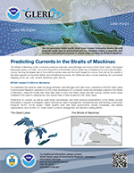
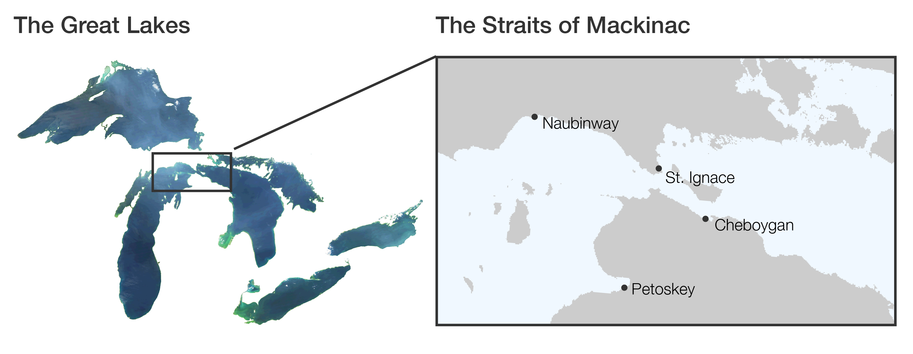
The Straits of Mackinac is the connecting waterway between Lakes Michigan and Huron of the Great Lakes—the largest freshwater system on Earth. Due to the unique flow of the Straits, the two lakes are considered to be one (Lake Mchigan-Huron), forming the largest lake in the world by surface area and the fourth largest by volume. Not only do the waters in this area support an important fishery and recreational economy, the Straits are also a crucial waterway for commercial shipping of iron ore, coal, cement, limestone, grain and oil.
NOAA research informs decisions
To understand the dynamic water exchange between Lake Michigan and Lake Huron, scientists at NOAA’s Great Lakes Environmental Research Laboratory (GLERL) have developed a 3D computer model that simulates currents in the Straits of Mackinac. Using the model, they have been able to show that these unique and fast moving currents would cause materials in the water to disperse far more quickly than in other locations in the Great Lakes.
Predictions of currents, as well as water levels, temperature, and other physical characteristics of the Straits, provide information in support of navigation, search and rescue, beach management, recreational use, and tracking contaminant transport. NOAA GLERL subject matter experts work with state governments, private companies, and federal organizations, such as the U.S. Coast Guard, to inform management and decision-making efforts.
The 3rd generation Great Lakes Operational Forecasting System (GLOFS) includes a hydrodynamic (the forces in or the motion of water) model of Lake Michigan-Huron aimed at providing improved predictions of water levels, water currents and water temperatures for the commercial, recreation, and emergency response communities.
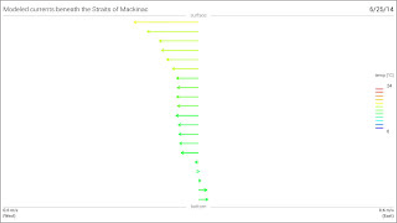
Straits of Mackinac models are validated by processing several years of field data on currents, temperatures from top to bottom, under ice measurements, and drifter buoy tracks.The currents in the Straits of Mackinac are complex, variable, and can be extraordinarily fast. Overall, water flows from Lake Michigan to Lake Huron. However, research has found that it also oscillates (moves back and forth) and changes direction on an average of once every 1.5 days. These exchanges, caused by wind, are often very fast and can move about 80,000 cubic meters of water per second (more than the volume of 32 Olympic swimming pools!) This can cause currents of up to 1 meter per second.
|
The currents
change direction roughly every 1.5 days. Click animation to enlarge 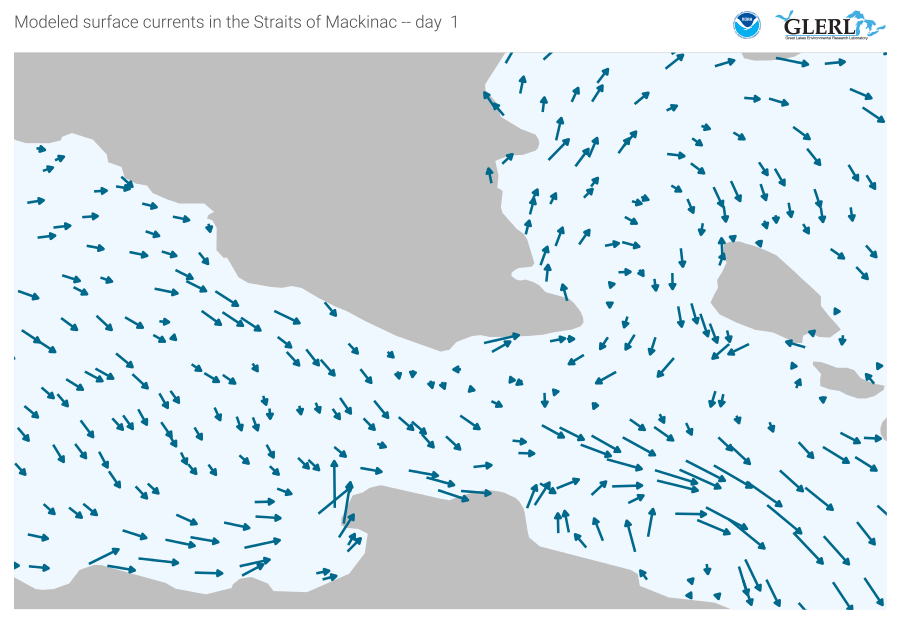
|
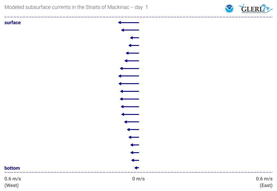
Surface and deeper
water flow in opposite directions during the summer. Click animation to enlarge
|
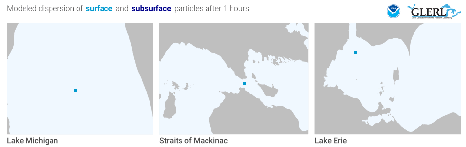
NOAA GLERL researchers conduct particle trajectory simulations (see animation below). These modeled scenarios illustrate the uniqueness of this oscillating flow and how it affects the potential transport of a substance (e.g. oil, sediment, or nutrients). To validate the model and to confirm circulation and particle pathways, drifter buoys are periodically released. The drifter buoys float with the currents and their tracks are compared to modeled results. These simulations illustrate the complex physical conditions in the Straits and the importance of ongoing research to improve models that provide information for management and decision-making efforts.
The graphic below is an example of how dispersion in the Straits of Mackinac would differ from other areas, such as in Lake Michigan and the western basin of Lake Erie.
General Information & Media Inquiries
Data Inquiries
