
NOAA - Great Lakes Environmental Research Laboratory

Data displayed on the NOAA Great Lakes Environmental Research Laboratory (GLERL) website is considered experimental. GLERL is located within NOAA Research. NOAA GLERL is providing these data "as is". Timely delivery of data and products through the Internet is not guaranteed. Before using information obtained from this website, special attention should be given to the date and time frame of the data and products being displayed. (see GLERL Disclaimer and Intellectual Property Notice)
GLERL collects environmental and physical observations through a variety of techniques. These techniques include: direct biological sampling, satellite remote sensing, in situ sensors and observing systems, and mobile platforms, such as vessels and autonomous vehicles. Observations of the physical, chemical, and biological components of the Great Lakes and coastal ecosystems supports studies and assessments, inform experiments and models, and ultimately predictions and forecasts.
How do I cite GLERL data located at NCEI?
The National Centers for Environmental Information (NCEI) is NOAA’s data archiving center. Many of the NOAA GLERL datasets are archived on the NCEI website. Please review the tabs on this page to find links to specific GLERL datasets located in the NCEI archives.
To cite GLERL data at NCEI, please use the “Data Citation” text located in the right menu on a dataset’s landing page at NCEI.
How do I cite data located only on the GLERL website?
Please use the following format:
NOAA. webpage name, optional: dataset subset. Great Lakes Environmental Research Laboratory, website URL.
Accessed MM/DD/YYYY.
For example, the citation for a subset of the Great Lakes Coastal Forecasting System (GLCFS)
data would look like this:
NOAA. Great Lakes Coastal Forecasting System (GLCFS), Lake Huron waves and currents from 2018-2020. Great Lakes Environmental Research Laboratory,
website, https://www.glerl.noaa.gov/res/glcfs/. Accessed: 4/12/2022.
Lake Depths Data
NOAA was engaged in a program to compile Great Lakes bathymetric (lake depth) data and make them readily available to the public,
especially to the communities concerned with Great Lakes science, pollution, coastal erosion, response to climate changes, threats to lake ecosystems,
and health of the fishing industry. Compilation of new bathymetry for the Great Lakes was an important part of this program, carried out cooperatively between NOAA
(NCEI and GLERL), and the Canadian Hydrographic Service. This new bathymetry provided a more detailed portrayal of lakefloor topography, and revealed
some lakefloor features seen for the first time
NOAA-GLERL is working to improve and expand the capacity to forecast effects of climate change on the Great Lakes and its ecosystem to reduce risk and improve resilience.
Great Lakes water levels are continuously monitored by U.S. and Canadian federal agencies in the region through a binational partnership. NOAA-GLERL relies on this water level data to conduct research on components of the regional water budget and to improve predictive models. Water level monitoring stations are operated by NOAA's Center for Operational Oceanographic Products and Services (CO-OPS) and the Department of Fisheries and Oceans' Canadian Hydrographic Service. The U.S. Army Corps of Engineers Detroit, Chicago, Buffalo) and Environment and Climate Change Canada play crucial roles in research, coordination of data and operational seasonal water level forecasts for the basin.
GLERL collects water temperature data from buoys and people deploying instruments from research vessels. GLERL also predicts Great Lakes water temperatures using NOAA scientific models.
GLERL collects surface current observations data from drifters and models and predicts Great Lakes currents using NOAA scientific models.
NOAA GLERL harmful algal blooms (HABs) and hypoxia research program uses an integrated approach to understand the environmental drivers of HABs and hypoxia to predict events. This approach includes using satellite images, remote sensing, buoys, a comprehensive monitoring program in Lake Erie, and Saginaw Bay, Lake Huron, and advanced genetic techniques to understand the long and short-term seasonal dynamics of HABs and hypoxia. The data collected are used to inform forecast models used by key Great Lakes stakeholder groups, such as drinking water managers.
NOAA GLERL makes long-term ecological observations, conducts targeted fundamental research on ecological processes, and provides data to develop models critical to understanding ecosystem structure and function. GLERL also develops models to forecast impacts of multiple stressors e.g., invasive species, climate, and nutrients on water quality, food webs and fisheries. GLERL observations, laboratory, and field experiments support the development of new concepts, models, forecasting tools and applications to evaluate and forecast impacts of, and mitigation strategies for, present and future ecosystem stressors
NOAA GLERL develops and uses remote sensing technology and products to record and observe the Great Lakes environment through the collection of data. Remote sensing technology enables observing, measuring, and monitoring of detailed and symoptic events on the eartlh's surface (land and water) and atmposphere through the use of satellite-based, airborne, and ship-based sensors that are remote from the objects or events being observed. These observations directly benefit a wide range of research and operational constituents such as commercial shippers, modelers, recreational users, and regional drinking water managers.
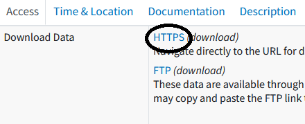
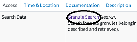
Datasets archived at NCEI are either a specific record or part of a collection1. To access data follow the instructions below.
1A collection is a grouping of environmental data or products that share common characteristics, is represented by a
single metadata record, and consists of one or more granules.
2A granule is the smallest aggregation of data that can be independently described and retrieved.
Contact:
Data Questions
General Information
