Station Map | Alpena | Cleveland Central | Muskegon | Saginaw Marker 1 | Toledo Marker 2 | West Lake Erie 

Realtime Coastal Observation Network (RECON) Station
SEAKEYS/Integrated Coral Observing Network (ICON) Station
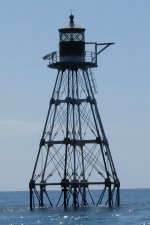
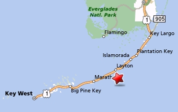
Tennessee Reef Light   Location: 24° 44.771´ N,   80° 46.928´ W,   Depth: 14 ft (4.3 m)

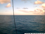
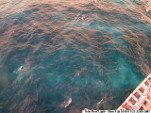
Photo of Station Map of Station Webcam Photos:
Click on Photo for Larger & Previous Images
Webcam Photo #1Webcam Photo #3
Webcam Photo #2Webcam Photo #4

[Selected Webcam Photos]


This station is no longer in operation.


Conditions around 3:00 pm EDT on Tue, Sep 27, 2011 (19:00 GMT)
 Data Plots
Engineering Data:   
Solar Panel Voltage: 52.2 volts   [Sep 27] Buoy Electronics
Battery Voltage: 52.2 volts   [Sep 27] Buoy Electronics
12V Bus Voltage: 12.00 volts   [Sep 27] Buoy Electronics
   
Signal Strength: -89.0 dB   [Sep 27] RSL at Shore Station

Last data download at Tue Sep 27 15:15:22 EDT 2011

In Partnership With:
Florida Institute of Oceanography Logo Seakeys Logo Keys Marine Lab Logo
ICON Logo


Alpena | Cleveland Central | Cleveland North | Grand Haven North | Grand Haven Pier | Grand Haven South | Muskegon | Saginaw Marker 1 | Tennessee Reef Light | Toledo Harbor Light | Toledo Marker 2 | West Lake Erie